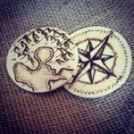
Woodburning mini maps on cheapo wooden circles I found at Michaels. Maps on the front, compass rose on the back! They’re each about 2.5 inches in diameter and suuuper thin, but really fun to work with.
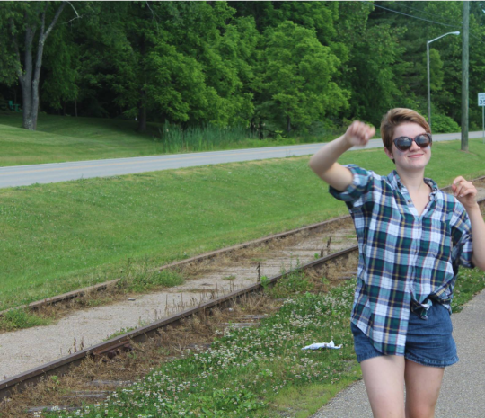
I just found this photo of me as a camp counselor for a wildlife and outdoors camp where they let me teach map & compass & orienteering and the thing is these kids were all from the city and they applied for this fully-funded program and it was the first time a lot of them had ever gone hiking and they were really nervous and I can’t help but think I probably didn’t inspire their confidence when I showed up
“hey kids I’ll be leading us all deep, deep into the woods today and probably we will all come back let’s roll”
this photo is of me teaching them how to count paces and obviously I cut all the kids out of the picture but in the original there are just a bunch of nervous looking youths following me
the most important thing about teaching orienteering at camp is there is usually and indoor portion when the kids learn the basics of looking at a map & compass and then an outdoor portion where we start applying the skills and I usually split that up with the other counselors so we weren’t always just doing the same thing and i LOVED it when I got the outdoor portion bc I’d lead the kids real deep into the woods and I’d be like
“okay, we’re definitely lost. y’all are gonna have to find our way back out of here, so who was paying attention inside earlier?”
and they’d be like “can’t you help”
and I’d say very seriously “I don’t know how to read a map.”
And they Always. Believed me.
wait let me make a correction. The High schoolers always believed me. The middle schoolers were less prone to immediate panic and I think that’s just part of the chaotic nature of being in middle school.
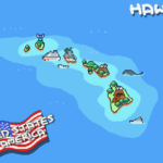
I love maps! For a while now I thought there should be a pixel art map of the world, the kind with landmarks stacked shoulder to shoulder as can often be found in poster shops.
The gargantuan piece measures 1325×851 pixels, three times the already huge Venezuela map. Just like the previous two, it’s also full of tiny, cute animations.
Head on over to the original blog post to explore everything from Las Vegas and the Grand Canyon on the West Coast to the Statue of Liberty and the White House on the East.
Maybe one day, we’ll get to see the whole world in pixels!
I will reblog this EVERY GODDAMN TIME so people can understand how the US government taking more and more land from Natives is nothing new (even the land originally promised after being kicked off their original, sacred lands) and they NEED to be fucking stopped. They need to be held accountable for the destruction of our people not just then but also now.
and the land left to us is still disrespected constantly, ever-shrinking, trespassed upon, and denied support 💁♀️