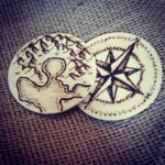
Woodburning mini maps on cheapo wooden circles I found at Michaels. Maps on the front, compass rose on the back! They’re each about 2.5 inches in diameter and suuuper thin, but really fun to work with.
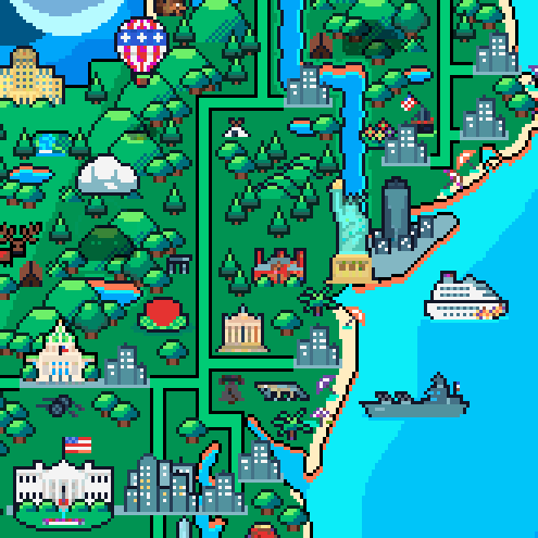
I love maps! For a while now I thought there should be a pixel art map of the world, the kind with landmarks stacked shoulder to shoulder as can often be found in poster shops.
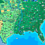
The gargantuan piece measures 1325×851 pixels, three times the already huge Venezuela map. Just like the previous two, it’s also full of tiny, cute animations.
Head on over to the original blog post to explore everything from Las Vegas and the Grand Canyon on the West Coast to the Statue of Liberty and the White House on the East.
Maybe one day, we’ll get to see the whole world in pixels!
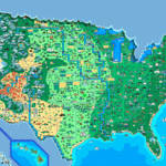
I will reblog this EVERY GODDAMN TIME so people can understand how the US government taking more and more land from Natives is nothing new (even the land originally promised after being kicked off their original, sacred lands) and they NEED to be fucking stopped. They need to be held accountable for the destruction of our people not just then but also now.
and the land left to us is still disrespected constantly, ever-shrinking, trespassed upon, and denied support 💁♀️
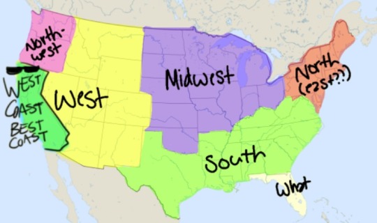
this is to educate my non-American followers. This really is how the US sees itself. (and yes, 95% of the time, Florida = WHAT?!)
In Florida the more North you go, the more “South” you get
In Florida the central part pretends to be the south, the western part pretends to be the northeast and the south pretends to be the west I’m not even kidding you
… Please tell me you guys are kidding.
Florida is like it’s own country I swear
I’m from Florida and I can confirm this. Also, South Florida is basically Miami and alligators.
oh, i always assumed florida was part of The South?
north florida is yes. The rest is not.
I’m from Florida, and grew up in SC/NC. Can confirm all true. 👍
Um. This is so wrong.
You’re forgetting the part where California sees itself as its own entity.
We do not want to be grouped in with everyone else, thanks.
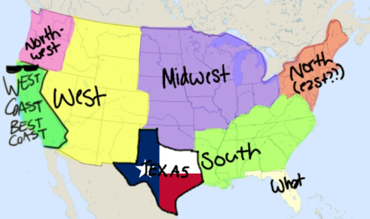
clearly none of you have ever met someone from texas
That last one is so true
I think what most people don’t consider is that the geographical labels we’ve put on different parts of America are a reflection of its history.
America, in its modern incarnation, formed over the course of nearly two centuries. The names given to the various regions of the country were often used without regard to the future cartographic accuracy of those titles.
As an example, a big part of the reason the south is called the south, has to do with the American Civil War. When the war happened, the south as we know it, was “The South”. Every other state that is literally on the southern side of the country – New Mexico, Arizona, California – weren’t part of the country until years later, so they were never included as part of that region.
This is south west erasure
Ah yes, the American South West. The Australia of the Northern Hemisphere.
hecc america is a chaotic entity and i hate that i am part of this
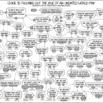
Guide to Figuring out the Age of an Undated World Map.
No but take the time to actually read it because I lost like 15 minutes.
I have a friend who is really good at this type of thing. He once found an old globe at a garage sale and he was able to pin the date of it’s making down to like a 6 month window, because it only would’ve been correct during a specific point in WWII.
I was mad impressed, because I have no mind for geography. I can barely remember my own state’s capitol.
THIS IS GOLD 😂😂😂
This is amazing. Take the time to actually read it.
Holy shit the super specific things towards the end
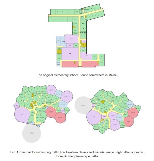
I eagerly await our new AI masters’ world of ultraoptimized, uncannily organic, evolving foorplans. Joel Simon:
Evolving Floor Plans is an experimental research project
exploring speculative, optimized floor plan layouts. The rooms and
expected flow of people are given to a genetic algorithm which attempts
to optimize the layout to minimize walking time, the use of hallways,
etc. The creative goal is to approach floor plan design solely from the
perspective of optimization and without regard for convention,
constructability, etc. The research goal is to see how a combination of
explicit, implicit and emergent methods allow floor plans of high
complexity to evolve. The floorplan is ‘grown’ from its genetic encoding
using indirect methods such as graph contraction and emergent ones such
as growing hallways using an ant-colony inspired algorithm.
Adds Simon: “I have very mixed feelings about this project.”